Improvement Homesite Value: Rural ROI Guide
Improvement Homesite Value. Discover how targeted land improvements boost homesite value in rural San Antonio. Learn selective clearing ROI, access prep
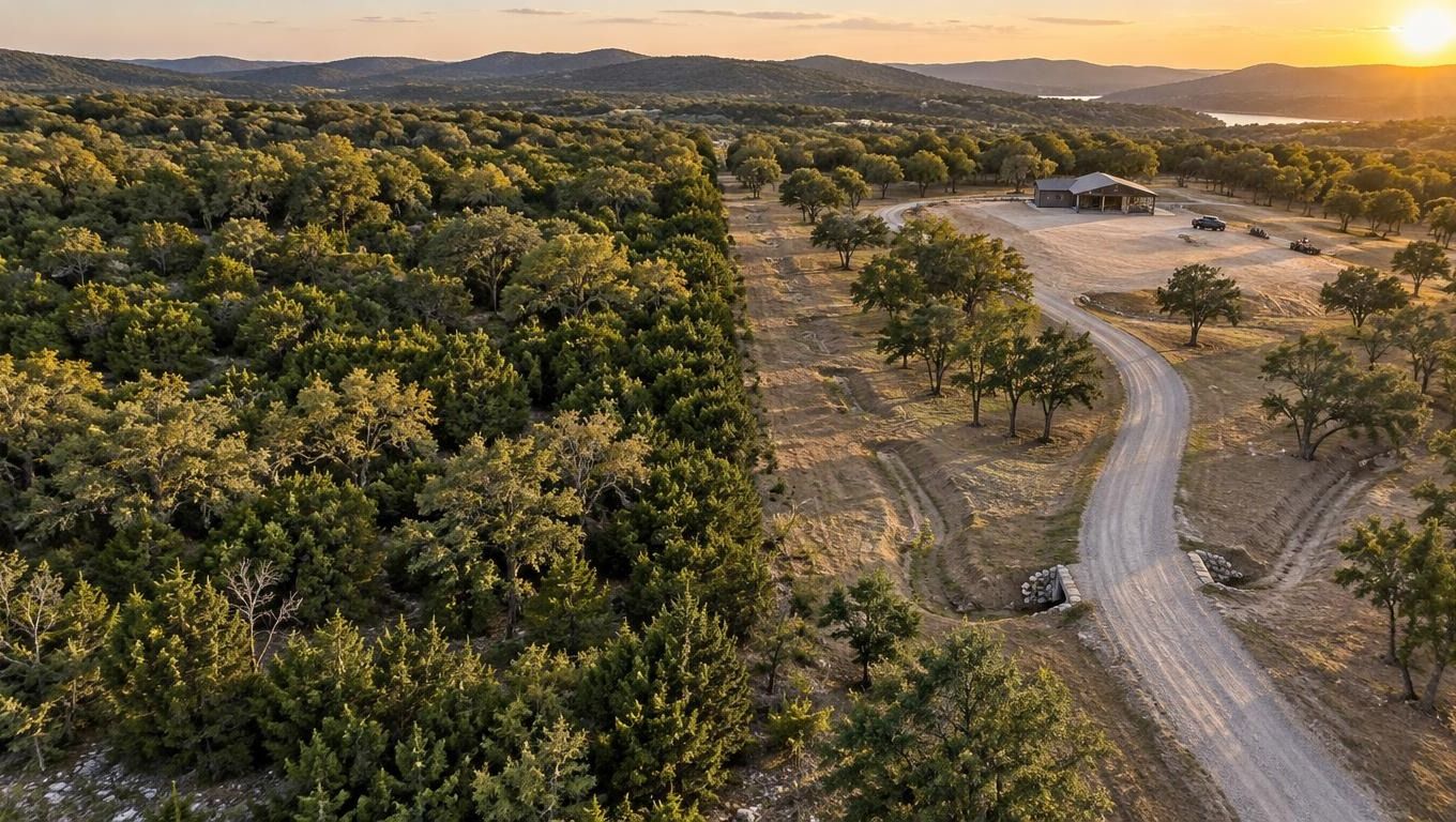
You've bought rural acreage outside San Antonio, cleared a narrow path to the front gate, and started imagining a house among the trees. Then you walk the property after rain and find standing water near the only level ground. The driveway is rough, the fence line has disappeared into brush, and the place that looked like a homesite on a map feels more like inaccessible pasture.
That experience explains why two similar tracts can perform very differently on the market. Improvement homesite value comes from making land usable, serviceable, and easy to understand, not from removing every tree or spending money on work that buyers can't see or appraisers can't recognize. The practical question is simple: which improvements create marketability, and which ones are only labor costs?
Table of Contents
- Why Two Similar Properties Sell Differently
- How Appraisers Calculate Homesite Value
- The Best Land Improvements for ROI
- Selective Clearing Versus Total Removal
- Preparing Acreage for Sale or Development
- Planning Your Land Improvement Strategy
Why Two Similar Properties Sell Differently
At the end of a private driveway in rural South-Central Texas, two neighboring properties can look nearly identical from the road. They may have comparable acreage, similar terrain, and the same broad appeal to buyers searching for a homestead or weekend property. Yet one attracts showings quickly while the other sits because buyers can't tell where they would build, how they would reach it, or what work lies ahead.
The difference often becomes obvious once you leave the road. On the stronger property, a stable lane leads to a defined homesite. The brush is opened enough to show the building area, mature trees frame the view, and a buyer can walk the ground without pushing through dense growth. On the other tract, clearing may have happened in scattered patches, leaving slash, uncertain access, and no clear relationship between the road, the building area, and the rest of the land.
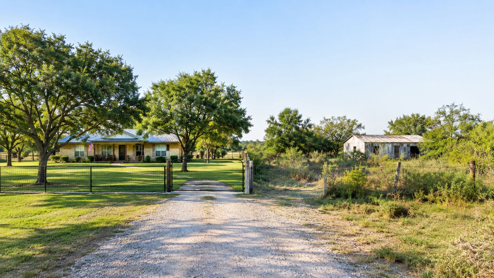
Buyers purchase confidence, not acreage alone
A rural buyer usually has to solve several problems before making an offer. They need to understand access, utilities, drainage, topography, vegetation, boundaries, and the likely cost of turning a promising area into a functioning homesite. If the property answers those questions during a showing, the buyer can focus on its strengths. If it raises more questions, the buyer often protects themselves with a lower offer or moves on.
That distinction matters around San Antonio, where acreage can shift quickly from open pasture to dense cedar, brush, wooded draws, and uneven ground. A cleared patch isn't automatically a homesite. It needs to connect logically to a driveway, have practical room for construction, and avoid creating drainage or erosion problems.
Practical rule: Clear the land so a buyer can understand how to use it, not simply so the property looks more open from the road.
Visible work must support a real use
A usable approach lane, an open fence corridor, and a defined building area can make a property easier to inspect and photograph. Those improvements may also reveal views, mature trees, pasture potential, or a natural location for a barn or shop. By contrast, broad clearing without a plan can leave exposed soil, remove shade, and create an area that feels unfinished.
The strongest projects usually have a clear purpose. A homesite needs a buildable footprint and access. A livestock property needs pasture and dependable routes. A recreational tract needs trails and safe entry points. The value comes from matching the work to the use buyers are likely to recognize.
How Appraisers Calculate Homesite Value
A homesite is not every acre that happens to surround a future house. Rural appraisal and tax systems often treat the homesite as a distinct component, combining the underlying land value with improvements needed to make that location buildable and usable.
Oregon's homesite rule illustrates the mechanics. It states that homesite value equals the market value of bare land divided by the total acreage, plus the lesser of the depreciated replacement cost of necessary land improvements or a capped amount of $4,000, as described in the Oregon homesite valuation rule. The exact treatment varies by jurisdiction, but the principle is useful for Texas landowners: the site and the work required to make it functional may be evaluated separately from the broader tract.
Land value and improvement value are different questions
The land component reflects the underlying property and its potential uses. The improvement component concerns work such as access, utility connections, grading, drainage, and other features that make the location practical for construction. A wooded view may support desirability, but it doesn't replace a driveway. A cleared area may be visually attractive, but it doesn't prove that the ground drains properly or that services can reach the building site.
Appraisal guidance analyzes both off-site and on-site utility. Access, roads, drainage, grading, and support facilities form part of site analysis, while soil, water, climate, drainage, and potential uses influence the broader land assessment in the site valuation guidance from the University of British Columbia's Sauder School of Business.
That distinction prevents a common mistake. Owners often assume every dollar spent on clearing or grading transfers directly into resale value. It may not. The cost approach generally considers replacement cost new less depreciation, then adds land value, so expensive work can contribute less to market value than its invoice suggests. The Iowa State University Ag Decision Maker discussion of improvement value explains why landowners should separate the cost of an improvement from the value that buyers or an appraisal may assign to it.
What the calculation means on a rural property
Think of a homesite as a usable building envelope rather than a bare spot on a map. Its market position improves when a buyer can verify:
- Access: A vehicle can reach the intended building area without crossing unreasonable terrain.
- Serviceability: Utility access, water, and septic feasibility appear practical rather than speculative.
- Buildable ground: Clearing exposes an area that can support the planned use without unnecessary disturbance.
- Water management: Grading and drainage direct runoff away from the future dwelling and working areas.
- Relationship to the tract: The homesite has a useful view, privacy, shade, pasture connection, or proximity to existing infrastructure.
This is why a permitted driveway, power proximity, water availability, and septic feasibility can separate a recreational tract from a true homesite. Clearing can improve visibility and usability, but it shouldn't be described as proof of buildability unless the relevant site and permitting questions have been addressed.
The Best Land Improvements for ROI
The best return usually comes from removing uncertainty before adding cosmetics. A buyer can tolerate natural vegetation, an unfinished barn site, or a modest trail system if the property has a clear path toward use. Buyers hesitate when access is unstable, water collects in the building area, or no one can identify where construction should begin.
Start with the route in
Access deserves first attention because it affects every later activity. Contractors need to reach the site. Buyers need to inspect it. Delivery vehicles, septic installers, utility crews, and emergency responders all depend on a route that works in ordinary conditions, not only on a dry showing day.
Public appraisal manuals show measurable access adjustments, including a -10% adjustment for dirt-road access in one county schedule and -20% for rural dirt roads that aren't state maintained in another schedule, while the same guidance addresses drainage away from dwellings. These examples come from the Iredell County land appraisal procedures, and they show why access quality can carry more appraisal significance than broad cosmetic clearing.
Build or improve the route with the terrain in mind. Avoid sending water directly down the driveway, establish a stable travel surface, and preserve enough width for the vehicles that will use it. A short, well-planned lane to a defined homesite can do more for marketability than clearing a much larger area with no destination.
Control water before opening more ground
Drainage is the second priority. Technical housing guidance requires positive drainage away from dwellings to prevent standing water, a point also covered in the Iredell County appraisal procedures linked above. On rural acreage, a grading mistake can turn a newly cleared pad into a collection point for runoff, especially where an access lane or compacted soil changes the natural flow.
Look for low areas, existing channels, culverts, and places where runoff crosses the proposed driveway. Clearing should expose the terrain without stripping away every stabilizing root system. If grading, culverts, or engineered drainage are needed, include those scopes before treating the area as finished.
Prioritize improvements by function
| Improvement Type | Impact on Homesite Value | Appraisal Consideration |
|---|---|---|
| Stable driveway and practical access | Makes the site reachable and easier to inspect, build on, and maintain | Road surface, maintenance responsibility, drainage, and access quality can affect comparison |
| Drainage and positive site fall | Reduces standing-water concerns and protects the building area | The site should direct water away from the future dwelling and avoid creating runoff problems |
| Defined building footprint | Helps buyers understand the intended use and construction limits | Clearing alone doesn't prove soil suitability, septic approval, or final buildability |
| Utility-ready corridor | Makes service planning more concrete | Utility proximity and connection requirements must be verified locally |
| Selective vegetation removal | Improves sightlines and usability while retaining character | The value depends on what remains, how the work is finished, and whether the cleared area serves a purpose |
Forestry mulching can be useful where woody growth blocks routes or visibility, but it isn't a substitute for a site plan. Before choosing a method, compare the likely result with the guidance in is forestry mulching worth it. The right question isn't how much vegetation a machine can remove. It's whether the finished ground will support access, inspection, construction planning, or a clearly understood rural use.
Selective Clearing Versus Total Removal
Total removal creates an immediate visual change, which is why owners often choose it. The property looks bigger, equipment has fewer obstacles, and the cleared area may appear easier to mow. But a bare tract can lose the shade, habitat, privacy, and visual identity that make rural San Antonio acreage appealing in the first place.
Selective clearing takes more judgment. It removes invasive cedar, dense understory, volunteer growth, and brush that blocks important routes while preserving mature oaks, desirable native vegetation, and trees that frame the homesite. The result should look intentional, not untouched and not scraped clean.
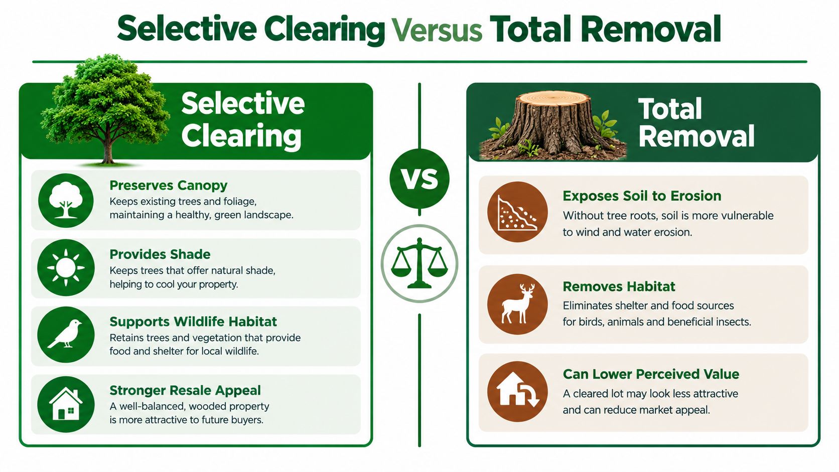
Compare the finished experience
Selective clearing generally works best where the owner wants a homesite with character. It can open a view from the future house, create room for a barn or garden, and establish a walkable route through the property without eliminating every natural feature. Buyers can see the usable space while still experiencing the land as acreage.
Total removal may make sense for a specific pasture reclamation or construction footprint, but it becomes risky when applied across the entire tract. Removing canopy can expose soil, increase heat, simplify the view, and make the property feel less established. It can also leave a large area that requires ongoing mowing or erosion control without improving the central homesite.
The right comparison isn't “cleared versus uncleared.” It is purposeful land versus disturbed land. A buyer may value a maintained opening with shade trees more than a much larger area that has no defined use. Appraisers and buyers also need to distinguish a genuine site improvement from work that only changes appearance.
Mark keep areas before equipment arrives
Walk the property in different conditions and identify what should remain. Mark mature trees, drainage features, useful shade, property monuments, fence locations, and any vegetation that protects the view or separates the homesite from a road or neighbor.
Then mark the work areas separately:
- Building footprint: The area required for the house, shop, barn, or other planned structure.
- Working room: Space for equipment, materials, turning movements, and future maintenance.
- Access corridor: The route from the road to the homesite and any secondary routes.
- View corridors: Openings that reveal desirable terrain without altering the entire terrain profile.
- No-disturbance areas: Drainage paths, sensitive ground, and trees that provide structure or shade.
A contractor who receives these boundaries can make better decisions than one told only to “clear the homesite.” For practical guidance on defining those limits, compare the process described in selective clearing services. The finished property should show where the investment went and why the remaining trees were worth keeping.
Preparing Acreage for Sale or Development
Preparation for a sale and preparation for a build overlap, but they aren't identical. A seller needs buyers to understand the property quickly. A builder needs enough information and access to make the next phase feasible. Both benefit from a site that can be inspected without forcing every visitor to guess what lies behind the brush.
Start with the areas buyers and contractors must see. Open the entrance, the primary driveway, the likely homesite, fence lines, and any feature that affects the property's use. A maintained trail can connect the road to a view, pasture, pond, or back portion of the tract. It doesn't need to turn every acre into a road network.
Make the property easy to inspect
A buyer who can't reach the back boundary may discount what they can't evaluate. A buyer who can't locate the homesite may assume the difficult ground, drainage, and access work will be expensive. Strategic cleanup reduces that uncertainty without pretending that clearing resolves permits, utilities, soil conditions, or final grading.
Focus on presentation that reflects real function:
- Clear the approach: Make the entrance and driveway understandable from the first visit.
- Expose boundaries: Open fence lines so a surveyor, buyer, or contractor can follow the property's shape.
- Create safe routes: Maintain trails that let people reach key areas without walking blindly through dense brush.
- Frame the homesite: Open the building area and preserve trees or terrain that give it privacy and character.
- Remove distracting debris: Process or remove brush piles that make the work look unfinished.
The improvement should survive more than a listing photo. If a clean-looking pad becomes muddy after rain or the access route funnels water toward the building area, presentation has hidden rather than solved the problem.
A practical overview of clearing sequence, equipment access, and construction preparation is available in how to clear land for a house. Use that type of planning to separate vegetation work from later pad construction and final grading, because those are related but distinct scopes.
The property should also be ready for honest documentation. Take photographs from the road, driveway, homesite, boundaries, and key natural features. Keep records of what was cleared, what was preserved, and which areas still need engineering, utility review, septic evaluation, or permitting.
A short video can show the relationship between the entry, access lane, cleared area, and surrounding trees more clearly than isolated photographs.
For development, don't market a cleared area as a guaranteed building site unless the relevant professionals have confirmed the requirements. For a sale, describe the work accurately. “Cleared homesite area with improved access” is useful information. “Ready to build” carries a broader meaning that may depend on drainage, soil, utilities, driveway approval, and septic feasibility.
Planning Your Land Improvement Strategy
Aggressive clearing feels productive because the change is visible. Strategic planning produces more durable value because every cut, route, and preserved tree supports a defined use. The owner who starts with a goal can decide what to improve, what to postpone, and what not to disturb.
A workable plan begins with the intended outcome. A homestead may need a house footprint, utility corridor, garden area, and routes for maintenance. A livestock owner may prioritize pasture reclamation, water access, and fence lines. A recreational owner may need trails, privacy, and selective openings rather than a broad cleared field.
Begin with a property walkthrough
Walk the boundaries before deciding where equipment should go. Note slopes, wet areas, existing roads, large trees, fence remnants, utility lines, structures, and natural routes. Look at the property from the road and from the likely house location, because a clearing plan that looks sensible on a map may create an unattractive or impractical result on the ground.
Separate needs from preferences. Access and drainage usually deserve earlier attention than a broad view corridor. A defined homesite may come before trail expansion. Brush removal near a fence may matter more than clearing a distant corner that no one will use.
Build phases around actual priorities
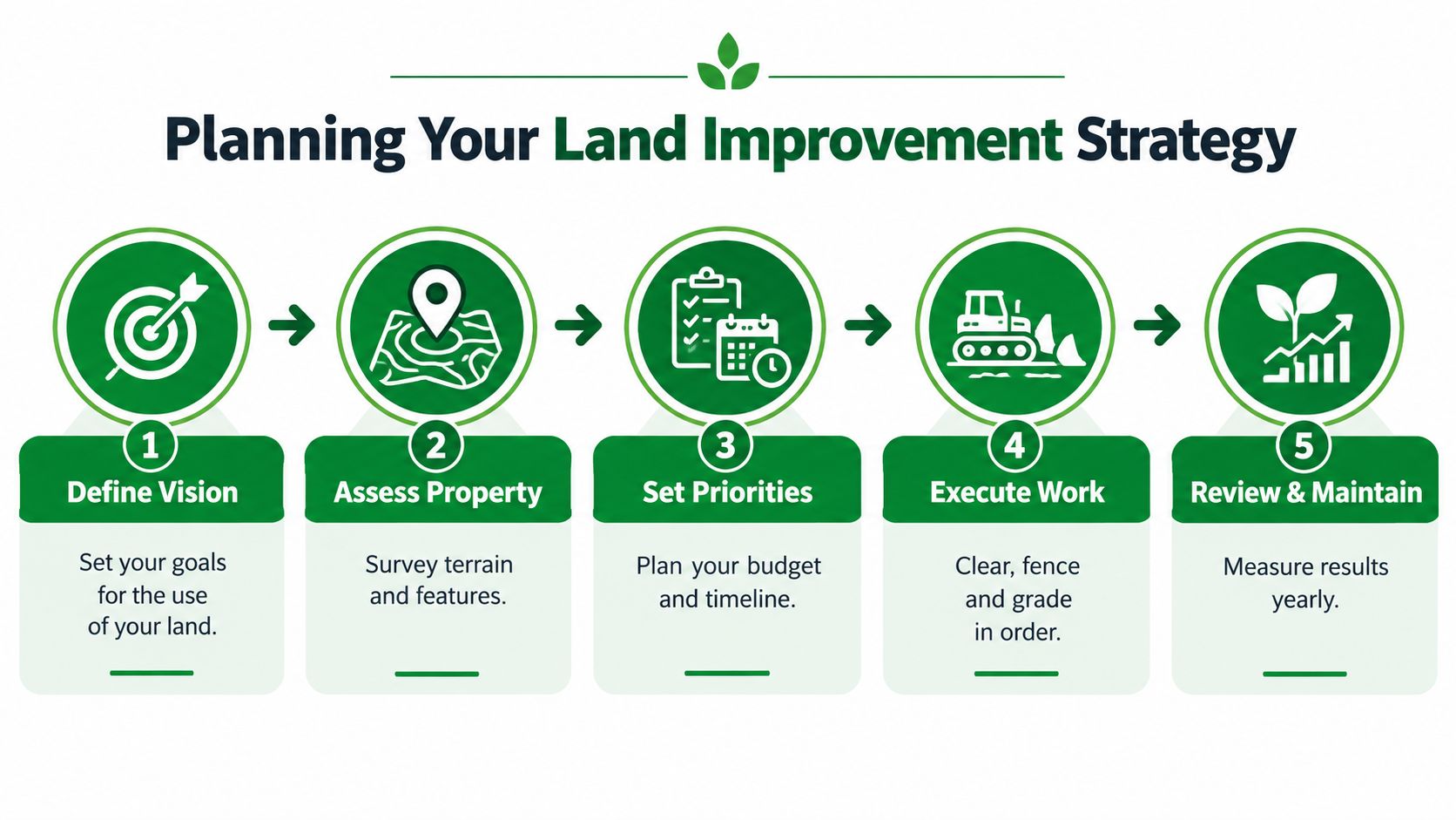
A phased plan protects the owner from spending the entire budget on visible clearing before the essential work is complete. A sensible sequence often looks like this:
- Define the use: Decide whether the immediate goal is a house, pasture, recreation, sale preparation, or general management.
- Assess the site: Identify terrain, vegetation, drainage, boundaries, existing access, and features worth preserving.
- Set priorities: Put essential access, water control, and the primary use ahead of optional cosmetic work.
- Execute in order: Clear routes and defined areas first, then address grading, fencing, utilities, or other separate scopes.
- Review and maintain: Walk the improved areas after use and weather, then control regrowth before access disappears again.
This approach also improves contractor communication. A scope can identify keep trees, cut areas, access lanes, trail widths, debris handling, and areas that require another professional. It gives the owner a finished condition to evaluate instead of an open-ended instruction to remove vegetation.
A useful test: If you can't explain what a cleared area will be used for, postpone clearing it.
Measure value through usability
The return on an improvement may appear as stronger buyer confidence, easier property inspection, lower uncertainty, or a more practical building process rather than a matching increase in appraised value. That doesn't make the work unimportant. It means owners should judge each project against the outcome it was designed to create.
Use photographs and notes to compare the property before and after work. Check whether vehicles can reach the intended areas, whether water moves away from structures, whether boundaries are visible, and whether the remaining trees and openings create a coherent setting. Maintenance matters too. A homesite that quickly returns to dense brush won't retain the usability that justified the original investment.
Fieldmark Land Co. offers property walkthroughs, project scoping, selective clearing, forestry mulching, brush removal, access and trail work, homesite preparation, pre-sale cleanup, and ongoing land management for rural properties around San Antonio. Visit Fieldmark Land Co. to discuss a use-based improvement plan that protects desirable trees while making access, homesite preparation, and long-term maintenance more practical.